КАРТИНКИ ЗАГРУЖАЮТСЯ...
Земельный участок (Продажа)
2 950 м²
Ссылка:
EDEN-T96145694
/ 96145694
Ссылка:
EDEN-T96145694
Страна:
PT
Город:
Algoz e Tunes
Категория:
Жилая
Тип сделки:
Продажа
Тип недвижимости:
Земельный участок
Площадь:
2 950 м²
ЦЕНЫ ЗА М² НЕДВИЖИМОСТИ В СОСЕДНИХ ГОРОДАХ
| Город |
Сред. цена м2 дома |
Сред. цена м2 квартиры |
|---|---|---|
| Алгош | 296 374 RUB | - |
| Гия | 473 265 RUB | - |
| Албуфейра | 425 582 RUB | 411 807 RUB |
| Албуфейра | 456 954 RUB | 422 929 RUB |
| Алкантарилья | 370 878 RUB | - |
| Фару | 371 617 RUB | 416 467 RUB |
| Боликейме | 391 850 RUB | - |
| Куартейра | 551 278 RUB | 522 450 RUB |
| Портиман | 327 186 RUB | 357 900 RUB |
| Фару | 398 133 RUB | 409 290 RUB |
| Сан-Браш-ди-Алпортел | 302 050 RUB | 262 198 RUB |
| Сан-Браш-ди-Алпортел | 289 663 RUB | 252 295 RUB |
| Эштой | 403 193 RUB | - |
| Ольян | 339 051 RUB | 380 214 RUB |
| Ольян | 336 392 RUB | 343 616 RUB |
| Монкарапашу | 391 307 RUB | - |
| Луш | 563 791 RUB | 493 775 RUB |
| Фузета | 353 200 RUB | - |
| Луш | 308 116 RUB | - |






- 300m2 Housing;
- 500m2 Commerce and Services;
- 500m2 Industry;
- 500m2 Buildings to Support Agriculture and Forestry;
- 2000m2 Tourism. As a reference point to highlight in terms of location, we have the well known restaurant "O FORAL". Additional information:
- GPS Coordinates: 37.190547,-8.257152
- A Previous Information Request to C.M.Silves is in process to obtain a certified document that it is possible to build, as it was informed by an accredited architecture office entity by analysis of the new PDM.Concepts and Uses Allowed in the Rural Agglomeration Classification in the new PDM:
1- Rural agglomerations correspond to built-up spaces, with a predominantly residential use and of support to activities located in rustic soil, having infrastructures and proximity services, but for which the classification of urban soil is not appropriate. 2- In rural agglomerations, the dominant use is housing, while compatible uses are permitted for commerce, services, tourism, industry, equipment, warehouses and agricultural and forestry support buildings, as well as units for the production, transformation or commercialisation of rural products. For any clarification, or to schedule a visit, we have a Team of Professionals prepared to give you all the attention you deserve. Показать больше Показать меньше Terrain à bâtir situé à Foral à São Bartolomeu de Messines avec classification de Village Rural dans le PDM de la municipalité de Silves. Cette parcelle a une superficie totale de 2920m2 et est située dans une zone qui, selon le nouveau PDM, est autorisée à la construction pour les fins les plus variées que je vais brièvement mentionner.
- 300m2 Logement ;
- 500m2 Commerce et services ;
- 500m2 Industrie ;
- Bâtiments de 500m2 pour soutenir l'agriculture et la sylviculture ;
- 2000m2 Tourisme. Comme point de référence à souligner en termes d'emplacement, nous avons le restaurant bien connu "O FORAL". Informations complémentaires :
- Coordonnées GPS : 37.190547,-8.257152
- Une demande d'information préalable à C.M.Silves est en cours pour obtenir un document certifié qu'il est possible de construire, comme il a été informé par une entité de bureau d'architecture accréditée par l'analyse du nouveau PDM.Concepts et utilisations autorisés dans la classification des agglomérations rurales dans le nouveau PDM :
1- Les agglomérations rurales correspondent à des espaces bâtis, à usage principalement résidentiel et de support à des activités situées en sol rustique, disposant d'infrastructures et de services de proximité, mais pour lesquels la classification en sol urbain n'est pas appropriée. 2- Dans les agglomérations rurales, l'usage dominant est le logement, tandis que les usages compatibles sont autorisés pour le commerce, les services, le tourisme, l'industrie, les équipements, les entrepôts et les bâtiments de soutien à l'agriculture et à la sylviculture, ainsi que les unités de production, de transformation ou de commercialisation des produits ruraux. Pour toute clarification, ou pour programmer une visite, nous avons une équipe de professionnels prêts à vous donner toute l'attention que vous méritez. Terreno para construção localizado no Foral em São Bartolomeu de Messines com classificação de Aglomerado Rural no PDM do concelho de Silves. Este terreno tem uma área total de 2920m2 e encontra-se numa zona que segundo o novo PDM é permitido a edificação para os mais variados fins que passo resumidamente a citar:
- 300m2 Habitação;
- 500m2 Comércio e Serviços;
- 500m2 Indústria;
- 500m2 Edifícios de Apoio À Atividade Agrícola e Florestal;
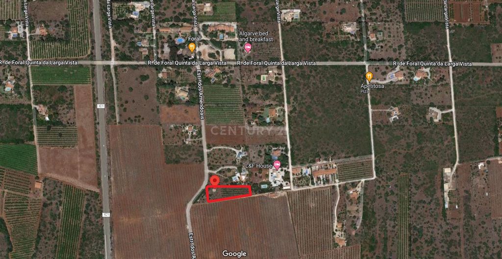
- 2000m2 Turismo. Como ponto de referência a destacar em termos de localização, temos o conhecido restaurante "O FORAL". Informações adicionais:
- Coordenadas GPS: 37.190547,-8.257152
- Existe postes de eletricidade junto ao terreno;
- Relativamente à água e ao saneamento básico, por se tratar de uma zona rural, haverá a necessidade de fazer um furo e uma fossa séptica, respectivamente.
- Encontra-se em processo um Pedido de Informação Prévio à C.M.Silves para obtenção de um documento certificado de que é possível construir, tal como foi informado por um gabinete de arquitetura credenciado entidade por análise do novo PDM.Conceitos e Usos Admitidos na Classificação de Aglomerado Rural no novo PDM:
1- Os aglomerados rurais correspondem a espaços edificados, com utilização predominantemente habitacional e de apoio a atividades localizadas em solo rústico, dispondo de infra-estruturas e de serviços de proximidade, mas para os quais não se adequa a classificação de solo urbano. 2- Nos aglomerados rurais, o usos dominante é habitação, admitindo-se como usos compatíveis o comércio, serviços, turismo, indústria, equipamentos, armazéns e edifícios de apoio à agrícola e florestal, bem como unidades de produção, transformação ou comercialização de produtos do meio rural. Para qualquer esclarecimento, ou agendamento de visita, temos uma Equipa de Profissionais preparados para lhe prestar toda a atenção que você merece. EN
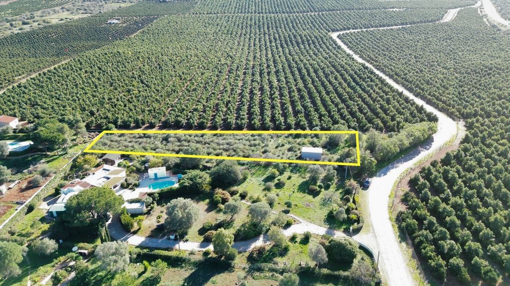
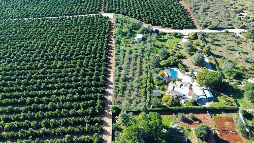
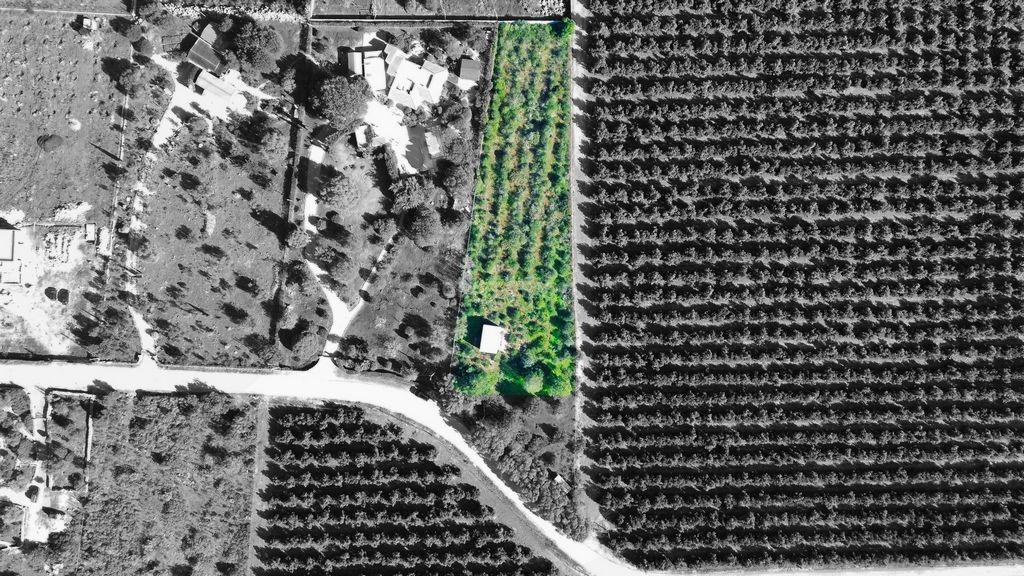
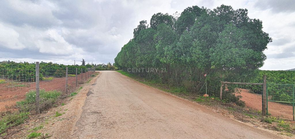
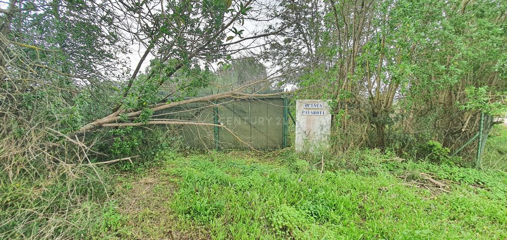
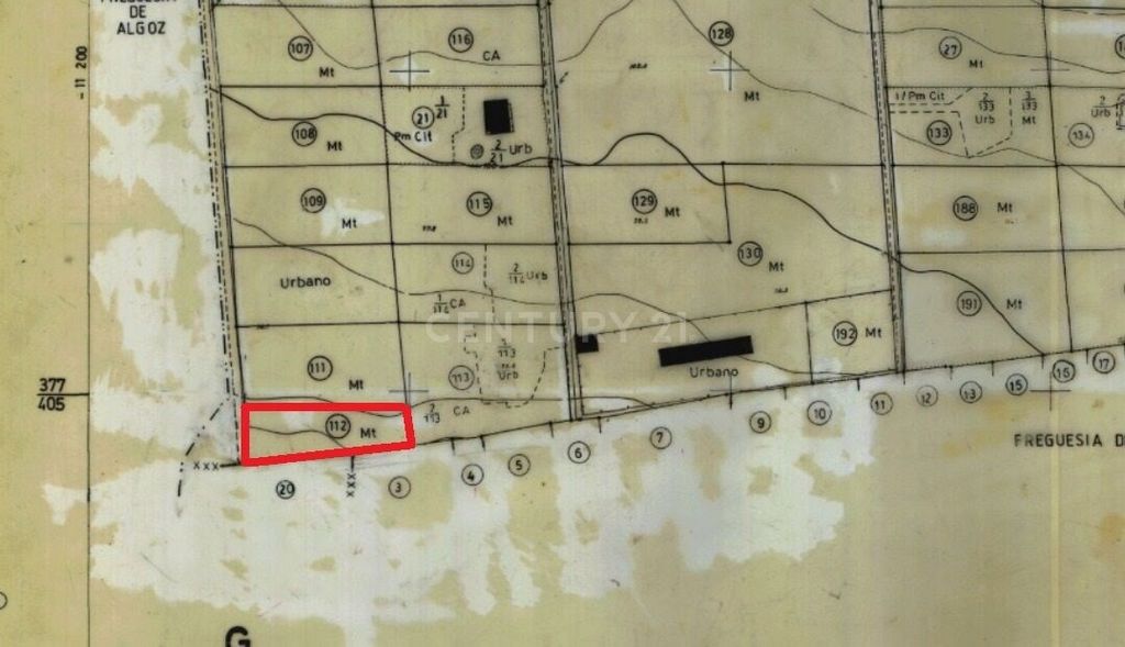
Land for construction located in Foral in São Bartolomeu de Messines with classification of Rural Village in the PDM of the municipality of Silves. This plot has a total area of 2920m2 and is located in an area that according to the new PDM is allowed the construction for the most varied purposes that I will briefly mention
- 300m2 Housing;
- 500m2 Commerce and Services;
- 500m2 Industry;
- 500m2 Buildings to Support Agriculture and Forestry;
- 2000m2 Tourism. As a reference point to highlight in terms of location, we have the well known restaurant "O FORAL". Additional information:
- GPS Coordinates: 37.190547,-8.257152
- A Previous Information Request to C.M.Silves is in process to obtain a certified document that it is possible to build, as it was informed by an accredited architecture office entity by analysis of the new PDM.Concepts and Uses Allowed in the Rural Agglomeration Classification in the new PDM:
1- Rural agglomerations correspond to built-up spaces, with a predominantly residential use and of support to activities located in rustic soil, having infrastructures and proximity services, but for which the classification of urban soil is not appropriate. 2- In rural agglomerations, the dominant use is housing, while compatible uses are permitted for commerce, services, tourism, industry, equipment, warehouses and agricultural and forestry support buildings, as well as units for the production, transformation or commercialisation of rural products. For any clarification, or to schedule a visit, we have a Team of Professionals prepared to give you all the attention you deserve. Land for construction located in Foral in São Bartolomeu de Messines with classification of Rural Village in the PDM of the municipality of Silves. This plot has a total area of 2920m2 and is located in an area that according to the new PDM is allowed the construction for the most varied purposes that I will briefly mention
- 300m2 Housing;
- 500m2 Commerce and Services;
- 500m2 Industry;
- 500m2 Buildings to Support Agriculture and Forestry;
- 2000m2 Tourism. As a reference point to highlight in terms of location, we have the well known restaurant "O FORAL". Additional information:
- GPS Coordinates: 37.190547,-8.257152
- A Previous Information Request to C.M.Silves is in process to obtain a certified document that it is possible to build, as it was informed by an accredited architecture office entity by analysis of the new PDM.Concepts and Uses Allowed in the Rural Agglomeration Classification in the new PDM:
1- Rural agglomerations correspond to built-up spaces, with a predominantly residential use and of support to activities located in rustic soil, having infrastructures and proximity services, but for which the classification of urban soil is not appropriate. 2- In rural agglomerations, the dominant use is housing, while compatible uses are permitted for commerce, services, tourism, industry, equipment, warehouses and agricultural and forestry support buildings, as well as units for the production, transformation or commercialisation of rural products. For any clarification, or to schedule a visit, we have a Team of Professionals prepared to give you all the attention you deserve.