КАРТИНКИ ЗАГРУЖАЮТСЯ...


Дом (Продажа)
участок 186 155 м²
Ссылка:
EDEN-T100532396
/ 100532396
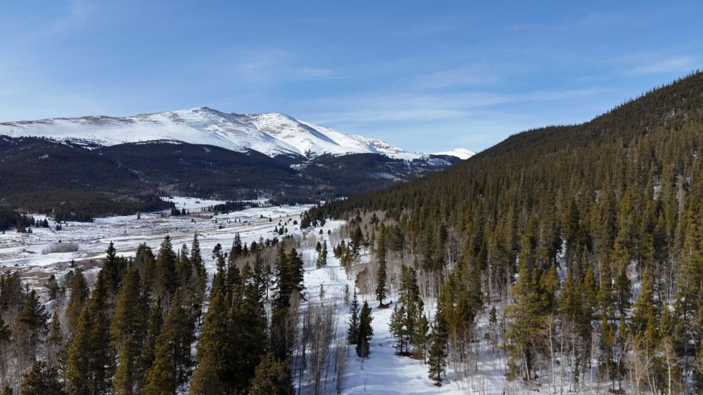
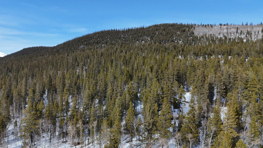
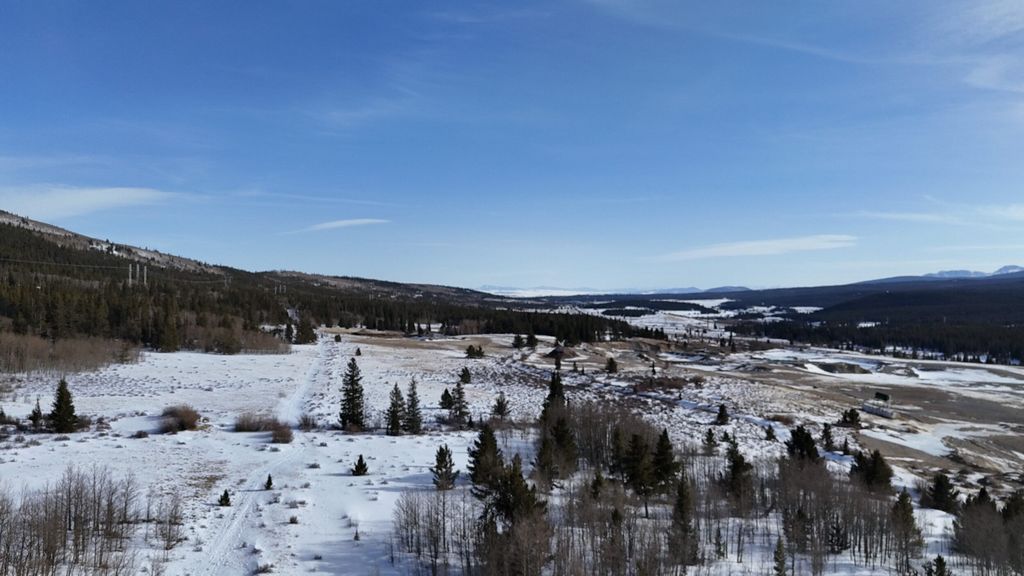
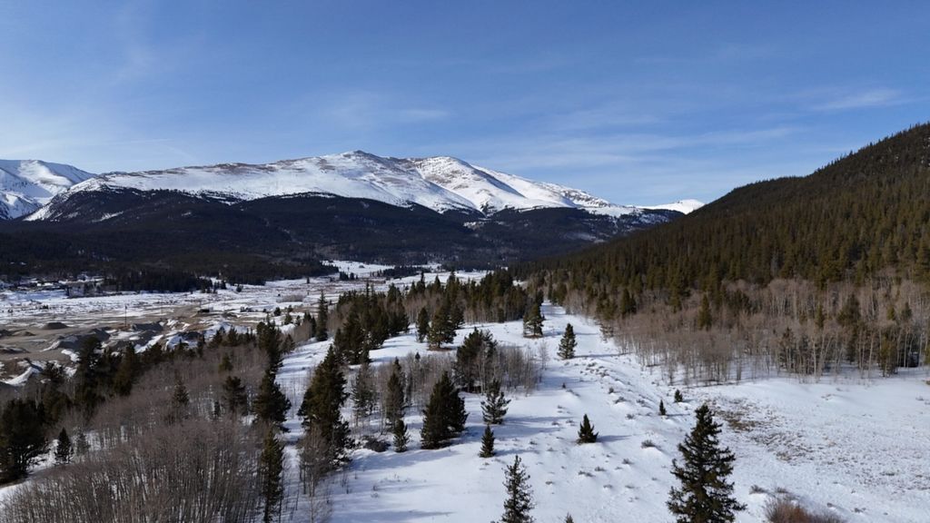
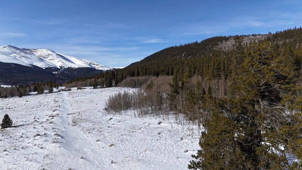
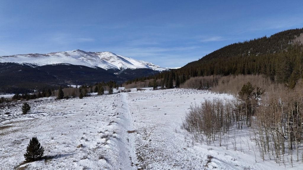
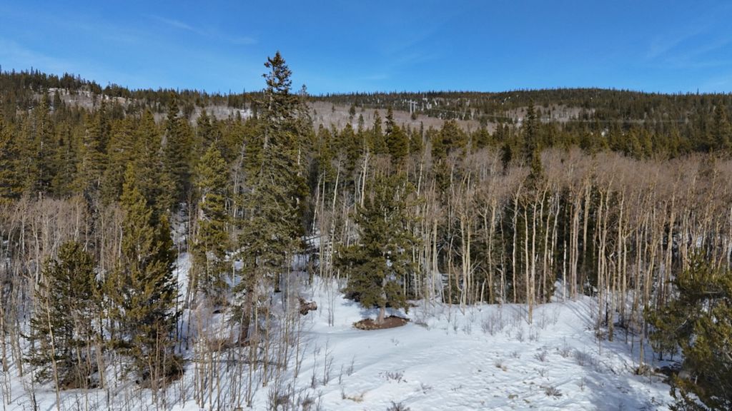
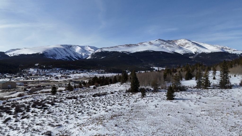
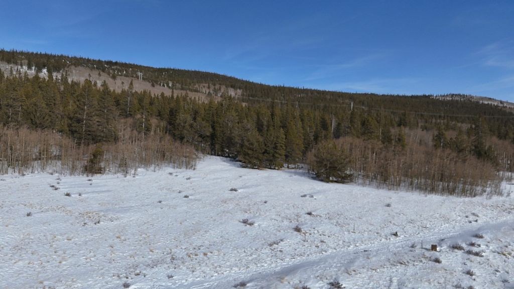
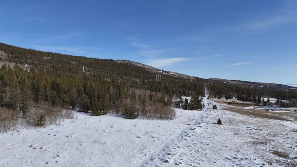
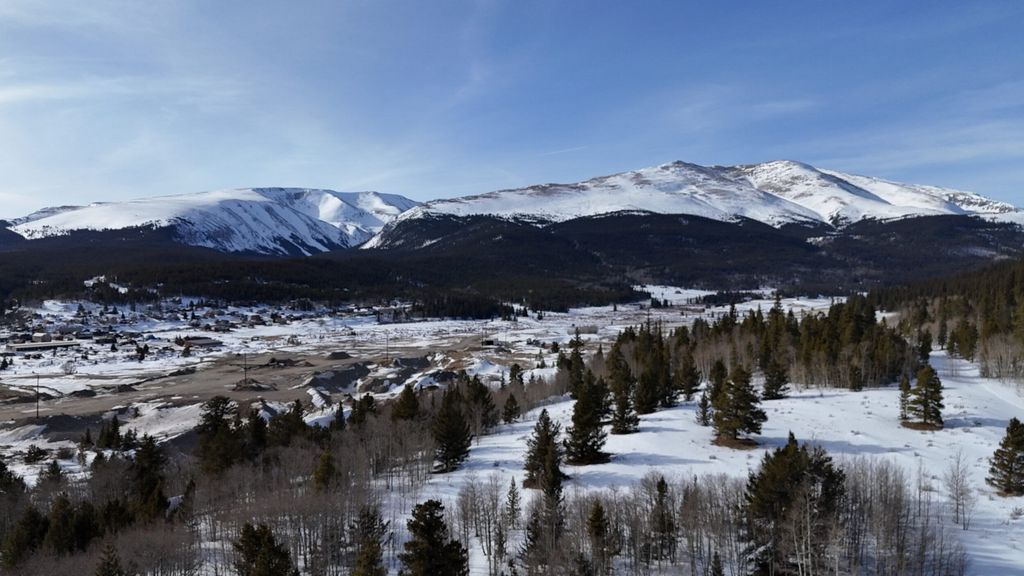
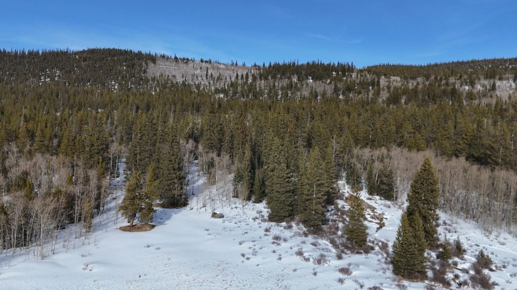
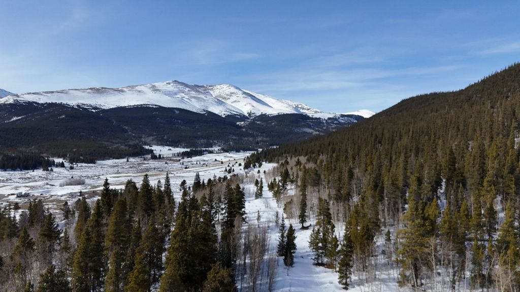
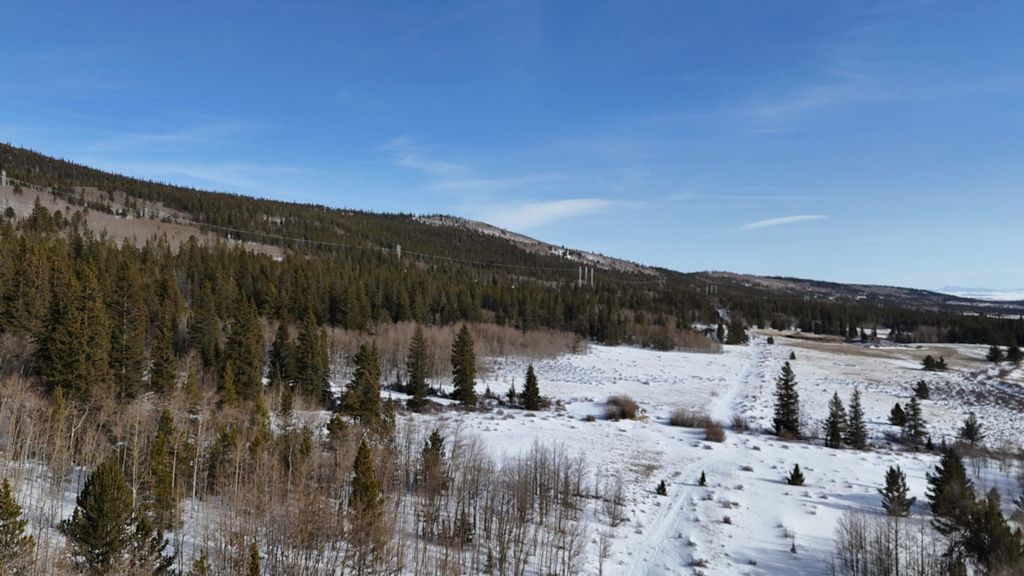
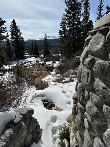
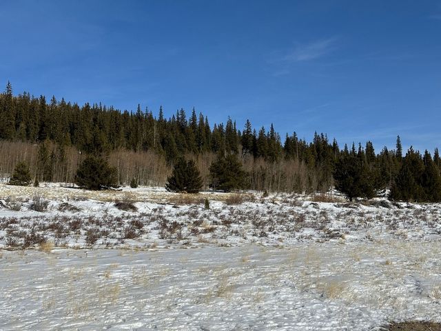
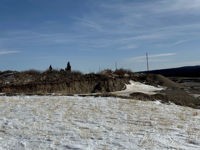
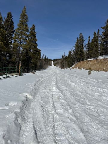
Forty seven (47) acres located on the ridgeline overlooking the historic town of Alma , Colorado with views of three 14,000 foot peaks, Mt Bross, Mt Democrat and Mt Lincoln. The property is an ideal location to build a primary or secondary get-away home nestled in the pines and aspen with majestic snowcapped views. World class skiing, hiking and fishing make this a year-round destination. The 47 acre property is divided into two parcels; (A) 32.18 and (B) 14.79 acres respectively. Parcel A , 32.18 acres, is adjacent to the Alma Placer Mine consists of open space, aspen and pine forest. There is significant value in the property derived from the untapped Gumaer Placer Mining Claim granted in 1889. Significant sand and gravel has been mined from the adjacent mine with similar production projected for Parcel A. In the 1930's, a gold pit was excavated producing traces of pure gold. The Columbia #1 Ditch runs north south through the parcel and power lines are located along the sawtooth ridgeline above the Placer Mine. Parcel B, 14.79 acres, is located to the east of Parcel A and rises nearly 120 feet to an elevation of 10,600 feet. The parcel and its pine forest is conveyed with its own water source; a natural spring is located in the lower portion, The two parcels are separated by a 66 foot wide strip of land owned by the City of Colorado Springs for an existing subgrade water pipeline (Red Hill Feeder Canal). The Gumaer Spring, dating back to 1884, is encapsulated by a river rock structure with outlet. The spring is documented by the State of Colorado Water Court dated August 21,1975 for 15 acre feet, with the right to refill and reuse as water is available. (20gpm) Alma , North America's highest incorporated town at 10, 578 feet, is ideally located close to several of Colorado's best ski areas including Breckenridge, Arapahoe Basin and Keystone. Nearby, the South Platte River has some of the most productive fishing in the state. Hiking, camping, mountain biking and hunting are easily accessible in Pike National Forest. Don't miss out on a classic tour of Buckskin Joe, an extinct gold mining town, two miles west of Alma. Parcel A, adjacent to the Alma Placer Mine, is relatively flat with shrubs, willows, dotted pines and aspen trees. Parcel B is heavy pine timber bordered on the lower portion by aspen trees. The spring produces a stream throughout the year. The Columbia #1` Ditch is a dry ditch that runs through the lower portion of the property. Water rights include the Gumaer Spring. Mineral rights are conveyed through the Gumaer Placer Mining Claim. Summers: Summers in Alma are pleasant, withmild days and chilly nights. Daytime temperatures typically reach the80s and occasionally the 90s, while evenings cool off to the50s and 60s. Wettest Months: The wettest months areJuly and Augustdue to thunderstorm activity. These months see increased precipitation. Spring and Autumn: Both spring and autumn are short but pleasant. Expectcool days and cold nights, occasionally dipping below freezing. Precipitation: Alma receives about15 inches of rain per year, which is relatively low. However, it averages a significant amount ofsnowfall-around 146 inches annually. Sunshine: Alma enjoys plenty of sunshine year-round, making it an ideal place for outdoor activities. Alma, originally named Fairplay Station, was later renamed Alma in 1867. The town grew as a mining community around Buckskin Gulch, where gold was first discovered. In the 1870s, Alma's population peaked at around 10,000 people. Today, with a population of 296 (2020), Alma holds the distinction of being the highest incorporated municipality in the United States with permanent residents, situated at an elevation of approximately 10,522 feet (3,207 meters). Its rich mining heritage and unique location make it a fascinating place to explore! The Property is located to on the eastern side of Alma and is accessible via CR 665. Alma, located along State Highway 9, lies north of Fairplay and south of Hoosier Pass and Breckenridge.
Показать больше
Показать меньше
Forty seven (47) acres located on the ridgeline overlooking the historic town of Alma , Colorado with views of three 14,000 foot peaks, Mt Bross, Mt Democrat and Mt Lincoln. The property is an ideal location to build a primary or secondary get-away home nestled in the pines and aspen with majestic snowcapped views. World class skiing, hiking and fishing make this a year-round destination. The 47 acre property is divided into two parcels; (A) 32.18 and (B) 14.79 acres respectively. Parcel A , 32.18 acres, is adjacent to the Alma Placer Mine consists of open space, aspen and pine forest. There is significant value in the property derived from the untapped Gumaer Placer Mining Claim granted in 1889. Significant sand and gravel has been mined from the adjacent mine with similar production projected for Parcel A. In the 1930's, a gold pit was excavated producing traces of pure gold. The Columbia #1 Ditch runs north south through the parcel and power lines are located along the sawtooth ridgeline above the Placer Mine. Parcel B, 14.79 acres, is located to the east of Parcel A and rises nearly 120 feet to an elevation of 10,600 feet. The parcel and its pine forest is conveyed with its own water source; a natural spring is located in the lower portion, The two parcels are separated by a 66 foot wide strip of land owned by the City of Colorado Springs for an existing subgrade water pipeline (Red Hill Feeder Canal). The Gumaer Spring, dating back to 1884, is encapsulated by a river rock structure with outlet. The spring is documented by the State of Colorado Water Court dated August 21,1975 for 15 acre feet, with the right to refill and reuse as water is available. (20gpm) Alma , North America's highest incorporated town at 10, 578 feet, is ideally located close to several of Colorado's best ski areas including Breckenridge, Arapahoe Basin and Keystone. Nearby, the South Platte River has some of the most productive fishing in the state. Hiking, camping, mountain biking and hunting are easily accessible in Pike National Forest. Don't miss out on a classic tour of Buckskin Joe, an extinct gold mining town, two miles west of Alma. Parcel A, adjacent to the Alma Placer Mine, is relatively flat with shrubs, willows, dotted pines and aspen trees. Parcel B is heavy pine timber bordered on the lower portion by aspen trees. The spring produces a stream throughout the year. The Columbia #1` Ditch is a dry ditch that runs through the lower portion of the property. Water rights include the Gumaer Spring. Mineral rights are conveyed through the Gumaer Placer Mining Claim. Summers: Summers in Alma are pleasant, withmild days and chilly nights. Daytime temperatures typically reach the80s and occasionally the 90s, while evenings cool off to the50s and 60s. Wettest Months: The wettest months areJuly and Augustdue to thunderstorm activity. These months see increased precipitation. Spring and Autumn: Both spring and autumn are short but pleasant. Expectcool days and cold nights, occasionally dipping below freezing. Precipitation: Alma receives about15 inches of rain per year, which is relatively low. However, it averages a significant amount ofsnowfall-around 146 inches annually. Sunshine: Alma enjoys plenty of sunshine year-round, making it an ideal place for outdoor activities. Alma, originally named Fairplay Station, was later renamed Alma in 1867. The town grew as a mining community around Buckskin Gulch, where gold was first discovered. In the 1870s, Alma's population peaked at around 10,000 people. Today, with a population of 296 (2020), Alma holds the distinction of being the highest incorporated municipality in the United States with permanent residents, situated at an elevation of approximately 10,522 feet (3,207 meters). Its rich mining heritage and unique location make it a fascinating place to explore! The Property is located to on the eastern side of Alma and is accessible via CR 665. Alma, located along State Highway 9, lies north of Fairplay and south of Hoosier Pass and Breckenridge.
Ссылка:
EDEN-T100532396
Страна:
US
Город:
Fairplay
Почтовый индекс:
80440
Категория:
Жилая
Тип сделки:
Продажа
Тип недвижимости:
Дом
Участок:
186 155 м²