374 971 446 RUB
4 628 481 квфут


In terms of cork, around 5,000 arrobas are harvested.
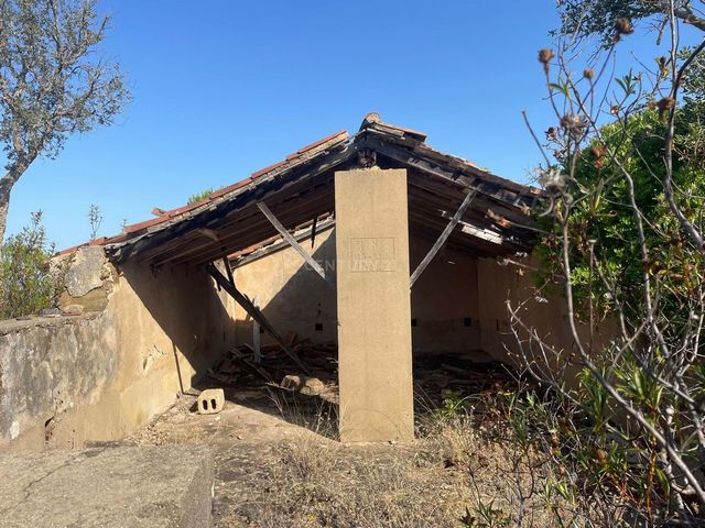
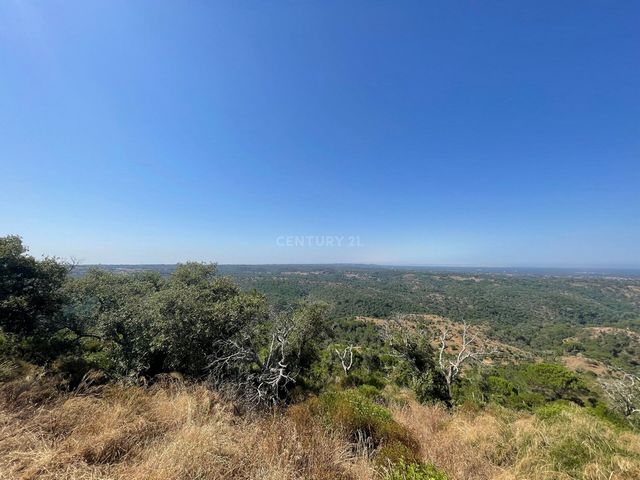
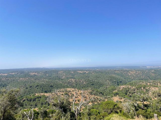
The land has several water lines, a fantastic view over the entire Alentejo coastline, and an agricultural dependency in ruins.
In terms of land use planning, the land is not covered by the National Agricultural Reserve (RAN) or the National Ecological Reserve (REN).
Edificability in Agricultural Areas allows for buildings to support agricultural, livestock and forestry activities (e.g. the owner-farmer's own home); recreational and leisure facilities; collective use equipment and infrastructures. The land is located 6 km from the IC 33, 6 minutes by car from the village of Melides, 10 minutes from Melides Beach and Melides Lagoon, and 20 minutes from Aberta Nova Beach.Melides is a parish in the municipality of Grândola, located on the coastal strip of the Alentejo coast, with excellent beaches (Melides, Galé, Vigia, Aberta nova), and lagoons (Melides and Santo André), a very typical and quiet village.
In addition to the fantastic, beautiful beaches, there are also hiking trails in the Serra de Grândola, along rural paths, along "going to the source" trails, along ridges of rare beauty, along fresh streams, paths that connect the people of the mountains to the coast and the lagoon, for those who prefer nature to the beach.
The climate is temperate-continental Mediterranean, with hot summers and cold winters with frosts, and little and irregular rainfall.
From a relief point of view, it has two distinct zones: on the coast, the heathlands predominate, with low fertility, occupied by pine and eucalyptus forests, and interspersed with two agriculturally attractive floodplains - Fontaínhas and, especially, the Melides floodplain, where rice cultivation abounds; - in the rest of the area, the mountains predominate, occupied by cork oak forests and some pine forests, mainly tame.
The population of Melides is spread across the three sectors of activity, although it is true that the older generation still finds its main means of subsistence in the income from the fields (agriculture, livestock and forestry). Показать больше Показать меньше Terreno rústico de 50 ha ( 500 000 m2), composto por montado de sobro (cortiça) 22 ha, floresta autóctone com 27 ha onde por exemplo temos carvalho, medronheiros, esteva e uma dependência agrícola.Em termos de cortiça, são retiradas cerca de 5000 arrobas.O terreno com várias linhas de água, uma vista fantástica sobre toda a costa alentejana, e uma dependência agrícola em ruínas.Em termos de ordenamento do território, o terreno não está abrangido pela Reserva Agrícola Nacional (RAN), nem pela Reserva Ecológica Nacional (REN).A Edificabilidade nos Espaços Agrícolas admite a edificação de construções de apoio às atividades agrícolas, pecuárias e florestal (ex: habitação própria do proprietário-agricultor); Instalações de recreio e lazer; Equipamentos de utilização coletiva e infraestruturas. O terreno localiza-se a 6 Km do IC 33, a 6 minutos de carro da aldeia de Melides, 10 minutos da Praia de Melides e da Lagoa de Melides, e a 20 minutos da Praia da Aberta Nova.Melides é uma freguesia do Município de Grândola, localizada na faixa litoral da Costa Alentejana, com excelentes praias (Melides, Galé, Vigia, Aberta nova), e lagoas (Melides e Santo André), uma aldeia muito típica e sossegada.
Além das fantásticas praias, com grande beleza, têm também percursos pedestres da Serra de Grândola, são percursos pedestres por caminhos rurais, por trilhos de "ir à fonte", por cumeadas de rara beleza, por frescas ribeiras, caminhos que ligam as populações da serra à costa e à lagoa, para quem prefere a Natureza à praia.
A nível climático enquadra-se no tipo temperado - continental mediterrânico apresentando verões quentes e Invernos frios, com ocorrência de geadas, e pluviosidade pouco elevada e irregular.Do ponto de vista do relevo apresenta duas zonas distintas: no litoral predominam as charnecas, de reduzida fertilidade, ocupadas por pinhais e eucaliptais, e entrecortadas por duas várzeas de apetência agrícola - Fontaínhas e, especialmente, a várzea de Melides, onde abunda o cultivo do arroz; - na restante área predomina a serra, ocupada por montados de sobro e algum pinhal, sobretudo manso.
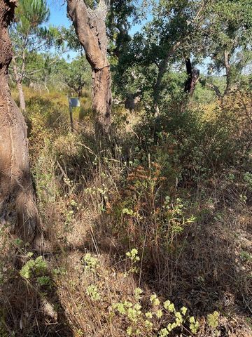
A população de Melides encontra-se distribuída pelos três sectores de atividade sendo, contudo, verdade que a geração mais velha encontra ainda nos proventos retirados dos campos (agricultura, pecuária e silvicultura), o principal meio de subsistência. Rustic land of 50 ha ( 500 000 m2), made up of cork oak forest (cork) 22 ha, native forest with 27 ha where for example we have oak, strawberry trees, cistus and an agricultural dependency.
In terms of cork, around 5,000 arrobas are harvested.
The land has several water lines, a fantastic view over the entire Alentejo coastline, and an agricultural dependency in ruins.
In terms of land use planning, the land is not covered by the National Agricultural Reserve (RAN) or the National Ecological Reserve (REN).
Edificability in Agricultural Areas allows for buildings to support agricultural, livestock and forestry activities (e.g. the owner-farmer's own home); recreational and leisure facilities; collective use equipment and infrastructures. The land is located 6 km from the IC 33, 6 minutes by car from the village of Melides, 10 minutes from Melides Beach and Melides Lagoon, and 20 minutes from Aberta Nova Beach.Melides is a parish in the municipality of Grândola, located on the coastal strip of the Alentejo coast, with excellent beaches (Melides, Galé, Vigia, Aberta nova), and lagoons (Melides and Santo André), a very typical and quiet village.
In addition to the fantastic, beautiful beaches, there are also hiking trails in the Serra de Grândola, along rural paths, along "going to the source" trails, along ridges of rare beauty, along fresh streams, paths that connect the people of the mountains to the coast and the lagoon, for those who prefer nature to the beach.
The climate is temperate-continental Mediterranean, with hot summers and cold winters with frosts, and little and irregular rainfall.
From a relief point of view, it has two distinct zones: on the coast, the heathlands predominate, with low fertility, occupied by pine and eucalyptus forests, and interspersed with two agriculturally attractive floodplains - Fontaínhas and, especially, the Melides floodplain, where rice cultivation abounds; - in the rest of the area, the mountains predominate, occupied by cork oak forests and some pine forests, mainly tame.
The population of Melides is spread across the three sectors of activity, although it is true that the older generation still finds its main means of subsistence in the income from the fields (agriculture, livestock and forestry). Ρουστίκ γη 50 εκταρίων (500 000 m2), αποτελούμενη από δάσος φελλοφόρου βελανιδιάς (φελλού) 22 εκταρίων, αυτοφυές δάσος με 27 εκτάρια, όπου για παράδειγμα έχουμε βελανιδιές, κουμαριές, κίστο και γεωργική εξάρτηση.
Όσον αφορά τον φελλό, συλλέγονται περίπου 5.000 arrobas.
Η γη έχει αρκετές γραμμές νερού, φανταστική θέα σε ολόκληρη την ακτογραμμή του Alentejo και μια γεωργική εξάρτηση σε ερείπια.
Όσον αφορά τον χωροταξικό σχεδιασμό, η γη δεν καλύπτεται από το Εθνικό Γεωργικό Απόθεμα (RAN) ή το Εθνικό Οικολογικό Απόθεμα (REN).
Η δυνατότητα δόμησης στις γεωργικές περιοχές επιτρέπει στα κτίρια να υποστηρίζουν γεωργικές, κτηνοτροφικές και δασοκομικές δραστηριότητες (π.χ. το σπίτι του ιδιοκτήτη-γεωργού)· εγκαταστάσεις αναψυχής και αναψυχής· εξοπλισμός και υποδομές συλλογικής χρήσης. Το αγροτεμάχιο βρίσκεται 6 χλμ από το IC 33, 6 λεπτά με το αυτοκίνητο από το χωριό Μέλιδες, 10 λεπτά από την παραλία Μελίδες και τη λιμνοθάλασσα Μελίδες και 20 λεπτά από την παραλία Aberta Nova.Το Melides είναι μια ενορία στο δήμο Grândola, που βρίσκεται στην παράκτια λωρίδα της ακτής Alentejo, με εξαιρετικές παραλίες (Melides, Galé, Vigia, Aberta nova) και λιμνοθάλασσες (Melides και Santo André), ένα πολύ τυπικό και ήσυχο χωριό.
Εκτός από τις φανταστικές, όμορφες παραλίες, υπάρχουν επίσης μονοπάτια πεζοπορίας στη Serra de Grândola, κατά μήκος αγροτικών μονοπατιών, κατά μήκος μονοπατιών "πηγαίνοντας στην πηγή", κατά μήκος κορυφογραμμών σπάνιας ομορφιάς, κατά μήκος φρέσκων ρευμάτων, μονοπατιών που συνδέουν τους ανθρώπους των βουνών με την ακτή και τη λιμνοθάλασσα, για όσους προτιμούν τη φύση από την παραλία.
Το κλίμα είναι εύκρατο-ηπειρωτικό μεσογειακό, με ζεστά καλοκαίρια και κρύους χειμώνες με παγετούς και λίγες και ακανόνιστες βροχοπτώσεις.
Από ανακουφιστική άποψη, έχει δύο διακριτές ζώνες: στην ακτή, κυριαρχούν οι χερσότοποι, με χαμηλή γονιμότητα, που καταλαμβάνονται από δάση πεύκων και ευκαλύπτων και διασκορπίζονται με δύο ελκυστικές γεωργικές πλημμυρικές περιοχές - Fontaínhas και, ιδιαίτερα, την πλημμυρική πεδιάδα Melides, όπου αφθονεί η καλλιέργεια ρυζιού. - Στην υπόλοιπη περιοχή κυριαρχούν τα βουνά, που καταλαμβάνονται από δάση φελλοφόρου βελανιδιάς και μερικά πευκοδάση, κυρίως ήμερα.
Ο πληθυσμός των Μελίδων κατανέμεται στους τρεις τομείς δραστηριότητας, αν και είναι αλήθεια ότι η παλαιότερη γενιά εξακολουθεί να βρίσκει το κύριο μέσο συντήρησής της στο εισόδημα από τα χωράφια (γεωργία, κτηνοτροφία και δασοκομία).